
Asset tracking cloud solutions
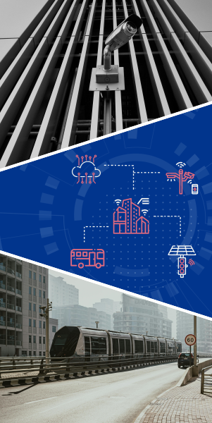
Intelligent cloud solutions for real-time smart city asset management
City-scale solutions design
Engineering the solutions for smart, sustainable, and responsive city of tomorrow
Municipal transport management
Creating efficient, connected, and user-centric urban transit experiences
Traffic & parking management solutions
Intelligent, real-time solutions for urban traffic and parking management
Connected infrastructure
The IoT and AI backbone for your city's physical assets
Asset tracking cloud solutions
- Real-Time GPS-Based Asset Tracking
- IoT-Enabled Asset Monitoring
- AI-Powered Predictive Maintenance
- Drone-Based Asset Inspection
- Public Transport & Micromobility Asset Tracking
- Indoor Asset Tracking for Public Facilities
- Environmental Asset Monitoring
- Geofencing for Restricted Asset Access
Approaches
- Sub-Second Location Updates
- AI-Based Motion Prediction
- Battery Optimization with Edge AI
- Self-Learning Failure Models
- AI-Based Demand Forecasting
- Dynamic Route Optimization
- Multi-Modal Journey Planning
Data Types
- GPS/GLONASS/Galileo/BeiDou data
- Timestamped asset location
- Speed and heading
- Sensor fusion data (accelerometer, gyroscope)
- Sensor readings (temperature, humidity, pressure, vibration, energy usage)
- GPS and telematics data
- Ticketing and passenger flow data
Technologies
- GPS Tracking: OpenCV (for motion analysis), GPSD, RTKLib
- IoT Frameworks: AWS IoT Core, Google Cloud IoT, ThingsBoard
- Edge AI Processing: TensorFlow Lite, OpenVINO
- AI/ML: TensorFlow, PyTorch, Scikit-learn
- Time Series Analysis: Prophet, Statsmodels
- Drone Control: ArduPilot, DJI SDK
- Routing & Optimization: GraphHopper, OpenTripPlanner
- Traffic Analysis: SUMO (Simulation of Urban Mobility)
- Indoor Positioning: OpenLocate, IndoorAtlas
City-scale solutions design
- Smart City Digital Twin Development
- GIS-Based Traffic & Mobility Management
- Smart Waste Management with GIS
- GIS-Based Disaster Risk & Emergency Management
- Environmental Monitoring & Sustainability Planning
- Urban Energy & Renewable Resource Mapping
- Smart Utility Network Management (Water, Electricity, Gas)
- Smart Parking & Geofencing Solutions
- Land Use & Zoning Optimization
- Smart City Security & Surveillance with GIS
Approaches
- Real-time 3D/4D visualization of urban infrastructure
- AI-driven simulations for traffic, energy, and environmental impact
- Integration of IoT sensor data with GIS for continuous monitoring
- AI-based real-time traffic flow optimization
- Multi-modal transport integration (buses, metro, micromobility)
- IoT-based smart bins with real-time fill level monitoring
- AI-based real-time disaster risk prediction and mapping
- GIS-driven emergency response coordination
Data Types
- GIS data (vector, raster, DEM, BIM)
- IoT sensor data (traffic flow, air quality, energy usage)
- 3D model data (CAD, BIM, CityGML)
- Real-time telemetry (weather, pollution levels)
- GPS telemetry (vehicles, public transport)
- Traffic camera feeds (CCTV, ANPR)
- Historical mobility patterns
- GIS-based risk models and hazard maps
- SCADA data (substation and pipeline monitoring)
- GIS utility network data
Technologies
- CesiumJS, Unreal Engine (3D visualization)
- GeoServer, PostGIS (spatial data management)
- TensorFlow, PyTorch (AI-driven analytics)
- Apache Kafka, RabbitMQ (event-driven data streaming)
- SUMO, MATSim (traffic simulation)
- OpenTripPlanner, GraphHopper (route optimization)
- QGIS, PostGIS (spatial analysis)
- PVGIS, WindPRO (renewable energy modeling)
- OpenDSS, GridLAB-D (smart grid simulation)
- EPANET, SWMM (water distribution modeling)
- OpenDSS, GridLAB-D (power network simulation)
Municipal transport management
- Real-Time Public Transit Tracking & Fleet Management
- Smart Ticketing & Fare Collection Systems
- Dynamic Route Optimization & Scheduling
- Demand-Responsive Transport (DRT) Solutions
- Integrated Multimodal Transport Platforms (Mobility-as-a-Service, MaaS)
- Predictive Maintenance for Municipal Transport Assets
Approaches
- Dynamic Routing & Re-routing
- Ultra-Low Latency Updates
- Predictive Analytics & Geo-Fencing
- Multi-Sensor Fusion
- Seamless Contactless Payments
- Adaptive Routing Algorithm
- On-Demand Ride Matching
- Unified Journey Planning
- AI-Driven Anomaly Detection
Data Types
- GPS coordinates (latitude, longitude, altitude)
- Telematics and sensor data (speed, acceleration, engine metrics)
- Timestamped event logs (arrival, departure times)
- Historical route and traffic patterns
- Real-time and historical traffic data
- Passenger count and ridership patterns
- Weather and incident reports
Technologies
- Routing & Simulation: GraphHopper, OpenTripPlanner, SUMO (Simulation of Urban Mobility)
- Transit schedules (GTFS for buses/trains, GBFS for bike-sharing)
- Real-Time Data Processing: Apache Kafka, RabbitMQ, Apache Spark
- AI & Data Analytics: TensorFlow, PyTorch, Scikit-learn, Kalman filter libraries
- IoT Platforms: AWS IoT Core, Azure IoT Hub
- Payment Integration: Stripe, Adyen, Braintree SDKs
- Data Analytics: Tableau, Power BI, or custom dashboards with D3.js
- Time Series Analysis: Pandas, Prophet, Statsmodels
Traffic and parking management solutions
- Intelligent Traffic Management Systems
- Adaptive Traffic Signal Control
- Traffic Prediction & Analytics Platforms
- Cameras and IoT-Enabled Smart Parking Systems
- Parking Reservation & Payment Systems
- Parking occupancy prediction algorithms
Approaches
- Real-Time Multimodal Data Fusion
- Centralized Command & Control
- Dynamic Signal Timing:
- Zone-Based Customization
- Automated Enforcement
- Demand-Responsive Parking Pricing Models
Data Types
- Video Streams: Live feeds from CCTV cameras.
- Sensor Data: Vehicle counts, speed measurements, occupancy rates, environmental data (e.g., weather, pollution).
- Telemetry & GPS Data: Real-time location and movement of public and private vehicles.
- Environmental Inputs: Weather conditions and time-of-day patterns.
- Historical Traffic Patterns: For model training and predictive analytics.
- Real-Time Parking Occupancy Detection
- Parking users data: Reservation, Transaction
Technologies
- Computer Vision: OpenCV, TensorFlow Object Detection API, YOLO for incident detection.
- Data Streaming & Processing: Apache Kafka, Apache Spark for real-time analytics.
- GIS & Mapping: Leaflet, Mapbox, or CesiumJS for visualization.
- Simulation & Modeling: SUMO (Simulation of Urban Mobility)
- IoT Platforms: AWS IoT Core, Azure IoT Hub for device management.
- Payment Gateways: Stripe, Adyen, Braintree for processing transactions.
Connected infrastructure
- Street Lighting Management
- Utility Infrastructure Management
- Traffic management infrastructure
- Smart Waste Management Infrastructure
- Public Transportation Infrastructure
- Environmental & Air Quality
- Connected Security & Surveillance
- Smart Road & Bridge Infrastructure Monitoring
Approaches
- Adaptive Lighting & Energy Optimization
- Anomaly & Leak Detection
- Predictive Analytics & Digital Twin
- Multimodal Data Fusion
- Dynamic Control & Routing
Data Types
- Ambient light measurements, motion detection events.
- Sensor readings (pressure, temperature, flow rates, voltage, current).
- Telemetry data and alarm logs.
- Historical performance and maintenance records.
- GIS data for asset geolocation.
- Live video streams and images.
- Vehicle counts, speeds, and occupancy levels.
- Historical waste collection logs.
- Air quality measurements: PM2.5, PM10, CO2, NOx, O3.
- Sensor alerts from emergency call stations.
Technologies
- IoT Platforms: AWS IoT Core, Azure IoT Hub.
- GIS Tools: ArcGIS API, PostGIS.
- Machine Learning: Scikit-learn, TensorFlow for predictive analytics.
- Simulation: SUMO for traffic modeling.
- Data Analysis: Pandas, NumPy, SciPy.
- Video Management: Milestone, Genetec platforms.