
Green zones management
Intelligent, data-driven management for municipal parks and green zones
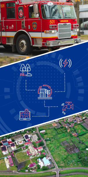
Complete geosolutions for local governance
Powering smarter governance with integrated, location-based intelligence
End-to-end cadaster management
The future of land registry: digital, automated, and intelligent
Smart energy systems integration
Unlocking the energy potential of your city's built environment
Water and wastewater management
Using AI and Digital Twins to manage your entire water cycle
Green zones management
- GIS-Based Green Zone Inventory Mapping, Simulation and Monitoring.
- Park and Recreational Area Management
- Environmental Monitoring and Sensor Integration
- Citizen Engagement and Reporting Platforms
Approaches
- Spatial Data Aggregation
- Remote Sensing & Analysis:
- Simulation & Modeling
- Asset & Facility Management:
- IoT Network Deployment
- Crowdsourced Data Collection
Data Types
- Raster Data
- Vector Data
- Metadata & Attribute Data
- Time Series Data
- Operational Data: maintenance logs, scheduling details, resource inventories.
- Crowdsources User-Generated Data: feedback, facility usage statistics, and incident reports.
Technologies
- Mapping & Visualization: Leaflet or OpenLayers for interactive web maps, Mapbox GL JS for advanced visualizations.
- GIS Processing: GDAL/OGR for data conversion and manipulation; Turf.js for geospatial analysis in web applications.
- Server-Side: GeoServer for serving spatial data; PostGIS (PostgreSQL extension) for spatial databases.
- Scheduling & Calendar: Libraries such as FullCalendar for scheduling interfaces.
- IoT SDKs: Eclipse Paho, and Mosquitto, AWS IoT SDKs or Azure IoT Hub SDKs.
Complete geosolutions for local governance
- Urban Planning and Land Management Solutions
- Municipal Asset and Infrastructure Management
- Emergency Response and Public Safety Management
- Environmental Monitoring and Sustainability Management
- Citizen Engagement and E-Governance Platforms
- Smart Transportation and Mobility Solutions
Approaches
- Data Aggregation & Visualization
- Simulation & Scenario Modeling
- Centralized Asset Registry
- Mobile Solutions for field teams
- Real-Time Situational Awareness
- Incident Mapping & Routing
Data Types
- Raster Data
- Vector Data
- Attribute Data
- Temporal Data
- Operational Data
- Sensor & IoT Data
- Incident Data
- Multimedia Data
- User-Generated Content
Technologies
- Mapping & GIS: Leaflet/OpenLayers, Mapbox GL JS, GDAL/OGR
- Backend & Data Management: PostGIS, GeoServer
- Simulation & Modeling: Custom-built tools or integration with platforms like CityEngine.
- Cloud IoT Platforms: Connect with AWS IoT, Azure IoT Hub, or Google Cloud IoT for scalability.
End-to-end cadaster management
- Digital Cadaster Mapping and GIS Integration
- Field Survey and Data Collection Solutions
- Historical Land Record Digitization and Management
- AI-assisted Property Valuation and Taxation
- Cadaster Data Management and Interoperability
Approaches
- GIS-Based Parcel Mapping:
- Automated Boundary Detection
- Layered GIS System
- Web GIS & Cloud Storage
- Mobile GIS Apps
- Solutions for Drone-Based Aerial Mapping
- OCR & NLP for Document Scanning
- Automated Metadata Tagging
- Machine Learning for Valuation Models: Predictive property price analysis.
- Cloud-Based Land Data Hubs
- API-Based Data Sharing
- AI-Driven Data Cleaning
Data Types
- Geospatial Data
- Remote Sensing Data
- Ownership & Registry Data
- Zoning & Planning Data
- GPS Coordinates & Survey Data
- Geotagged Photos & Videos
- Taxation Records
Technologies
- GDAL/OGR, GeoPandas (Python) – GIS data processing.
- OpenLayers, Leaflet.js (JavaScript) – Web GIS visualization.
- PostGIS, SpatiaLite – Spatial database management.
- QGIS, ArcGIS API – GIS software integration
- Tesseract OCR, Google Vision API – Document text extraction.
- QGIS Georeferencer Plugin – Aligning old maps with GIS.
- FME (Feature Manipulation Engine) – GIS data transformation.
Smart energy systems integration
- GIS-Based Renewable Energy Resource Assessment & Solar Atlas Creation
- Available Surface Measurement for Photovoltaic Panels & Small Wind Turbines
- Hybrid Energy System Planning & Optimization
- Smart Grid & Distributed Energy Resource (DER) Management
- Renewable Energy Financial & Economic Analysis and Control for Municipal Investments
Approaches
- Satellite & LiDAR-based Solar Irradiance Mapping
- Wind Resource Assessment using Computational Fluid Dynamics (CFD)
- Building Rooftop Geometry & Structural Data
- Microgrid Simulation for Renewable-Grid Integration
- Cost-Benefit & Lifecycle Analysis of Solar/Wind Projects
- Automated Subsidy & Incentive Management Platforms
Data Types
- Geospatial Data (Digital Elevation Models, Land Use, Building Footprints)
- Meteorological Data (Solar Irradiance, Wind Speeds, Temperature)
- LiDAR data , and high resolution imagery Data
- Energy Demand & Consumption Data (Smart Meters, SCADA Data)
- Renewable Energy Investment & Capital Cost Data
- Energy Generation & ROI Forecasts
Technologies
- GIS & Mapping: GDAL, GeoPandas, Leaflet, OpenLayers
- Renewable Energy Modeling: PVGIS, Solar Analyst (ArcGIS), WindNinja
- Machine Learning: TensorFlow, Scikit-Learn for energy resource prediction
- 3D Analysis & Modeling: Open3D, MeshLab, Rhino3D
- Energy System Simulation: HOMER, PyPSA, EnergyPlus
Integration Experience
- Municipal Energy Planning Tools (Integration with GIS portals)
- Smart City Dashboards (Connecting with real-time monitoring systems)
- Energy Policy Platforms (Providing data for renewable energy incentives)
Water and wastewater management
- GIS-Based Water Resource Planning & Management
- Subsurface utilities asset management solutions.
- Subsurface network digital twins development
- Flood Risk Management & Stormwater Drainage Optimization
- Smart Water Metering & Consumption Analytics
Approaches
- Smart Water Distribution & Leak Detection
- Smart Wastewater Management & Treatment Optimization
- Water Quality Monitoring & Pollution Control
- Hydrological Modeling (watershed analysis, groundwater flow simulation, Urban Drainage System Optimization)
- Climate & Weather Data Integration for Water Demand Forecasting
- AI-Driven Water Allocation Optimization
- Water Quality Monitoring Using IoT Sensors
- AI-Driven Asset Condition Monitoring
- 3D GIS-Based Utility Network Visualization
- Predictive Maintenance Using Digital Twin Technology
- AI-Based Flood Prediction Using Historical & Real-Time Data
- GIS-Based Floodplain & Drainage Mapping
- IoT Water Level Sensors for Real-Time Flood Alerts
Data Types
- Geospatial Data (DEM, LiDAR, satellite imagery)
- Hydrological Data (rainfall, river flow, groundwater levels)
- Weather Data (temperature, humidity, precipitation forecasts)
- Water Quality Parameters (pH, turbidity, contaminants)
- Geospatial Utility Network Data (pipelines, cables, sewer systems)
- Sensor Data from Smart Valves, Flow Meters, Leak Detectors
- Historical Maintenance & Repair Logs
- Water Consumption Data from Smart Meters
Technologies
- Mapping: ArcGIS, QGIS, Google Earth Engine
- GIS & CAD Integration: ArcGIS Utility Network, AutoCAD Map 3D, FME
- Digital Twin Platforms: Bentley iTwin, Dassault Systèmes 3DEXPERIENCE
- Hydrological Modeling: SWAT, HEC-HMS, MODFLOW
- Remote Sensing & Image Processing: GDAL, Rasterio, OpenCV
- AI & Data Analytics: TensorFlow, Scikit-learn, Pandas
- Billing & CRM Integration: SAP IS-U, Oracle Utilities